
Energy
Renewables
As renewable energy technology evolves, creating strong relationships with landowners and their communities remains critical to a project’s success. Doyle provides high-quality land acquisition, project development consultation, and custom database and GIS mapping services to solar and wind industry clients nationwide. We specialize in locating optimal, cost-effective sites to fit every client’s unique needs from project conception to interconnection. Sectors we service include utility-scale solar, utility-scale wind, electric transmission line interconnections, community solar, battery storage, and hydro-pump stations.

Renewables Services
Project Management
Our project management is what sets us apart. We know how to drive a tight schedule, communicate with landowners, and keep you well-informed on every detail of our activities. We require regular, detailed and clear reporting from our team members so you can report to your leadership and we can make the difficult decisions when the project is at a crossroads.
Easement, Lease and Fee Acquisition
Throughout the Easement, Lease, and Fee Acquisition phase, we work diligently to secure the land rights and agreements for your infrastructure projects. Our decades of negotiation experience has led to the development of successful acquisition strategies and processes that can be customized to meet your project’s unique objectives and timeline.
GIS / Strategic Mapping for Site Evaluation and Selection
Using the GIS search and filtering tools, we identify the sites that best fit the project’s criteria, including proximity to facilities, ownership characteristics, size, topography, and zoning/permitting characteristics. We can quickly score every parcel in a state or region, instantly identifying high-quality solar or wind sites.
ROW Strategy and Execution for Interconnection to Transmission
Backed by decades of experience in the Right of Way industry, we’re able to help our clients identify the best interconnection routes and acquire the necessary agreements from landowners.
Title and Landowner Identification
An accurate identification of property ownership, related rights, and encumbrances is crucial to successful land acquisition. Our diligent investigation helps mitigate risks and safeguard investments for both project developers and landowners.
Public Outreach
Public Outreach cultivates understanding, trust, and collaboration between your project and the surrounding communities. Our team works with you and all relevant partners to develop and implement custom outreach strategies that foster positive relationships, address concerns, and ensure transparent communication with stakeholders throughout your project’s lifecycle.
Acquisition Status
Tract Information
Existing Wind and Solar Projects
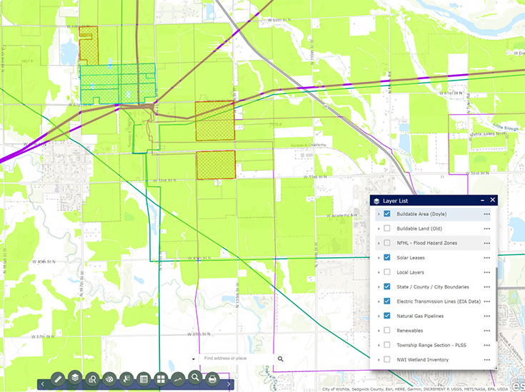
Buildable Area
Sample Maps
For Renewables
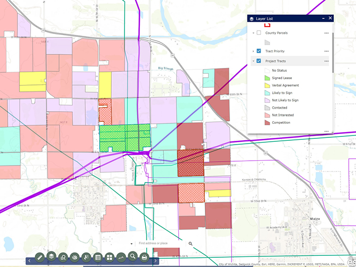
Acquisition Status
This layer allows us to easily visualize where we are having success and where we need to make more progress in the negotiation and acquisition process.
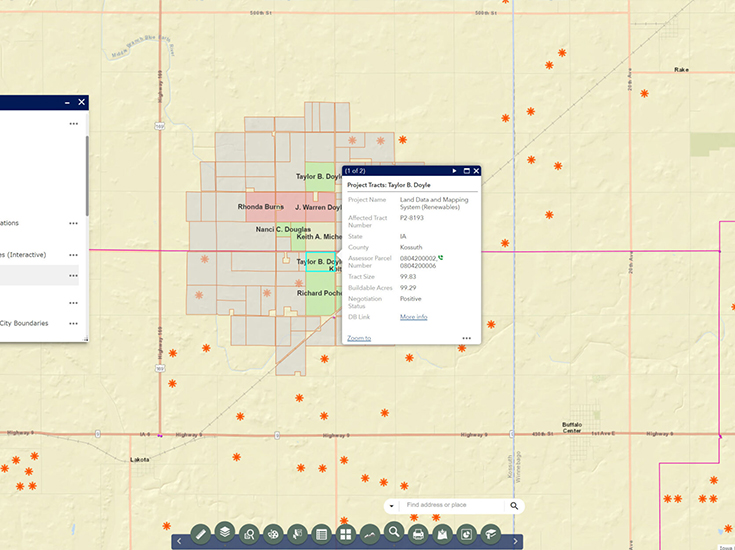
Tract Information
We use this system to visualize target areas and quickly identify high-priority parcels based on proximity to a substation, transmission line, or other point of interconnection.
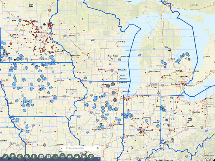
Existing Wind and Solar Projects
Our mapping system contains a multitude of layers that help us identify high-priority sites, including a layer that shows existing wind and solar projects.
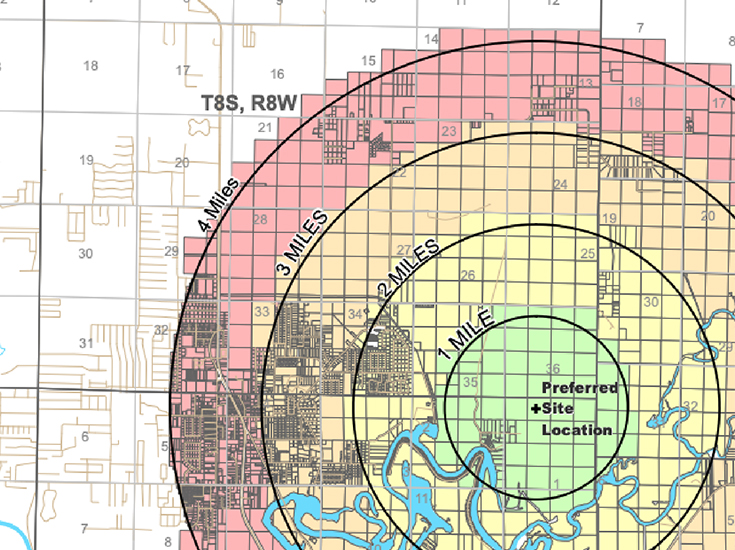
Buildable Area
Using multiple criteria, including slope, wetlands, and zoning restrictions, we can see which areas are the most suitable for renewable project developments.

Doyle Data and GIS Mapping System
Doyle utilizes cutting-edge Geographic Information System (GIS) technology, allowing us to manage every detail of your right-of-way project. This application not only centralizes data management, but also allows clients and field staff to remotely access reporting, mapping, and file-sharing tools.