Doyle Data & Mapping
Industry-Leading Land Management Software
Doyle Data
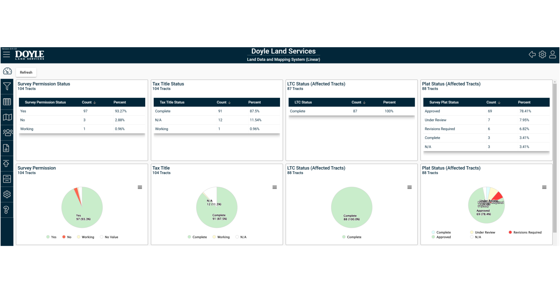
The Doyle Data and GIS Mapping System is a secure, web-based application, specifically designed to support and manage all aspects of a right-of-way project. This application not only centralizes information, but also allows our clients and field staff to remotely access reporting, mapping and filesharing tools. In fact, every database, report design and data delivery method can be easily customized to fit your specific project needs.
- Line List Report
- Survey Permission Status
- Exhibit Plats
- Plat Delivery
- Title Status
- Contact Logs
- ROW Acquisition Status
- Condemnation Tracking Report
- Construction Conditions
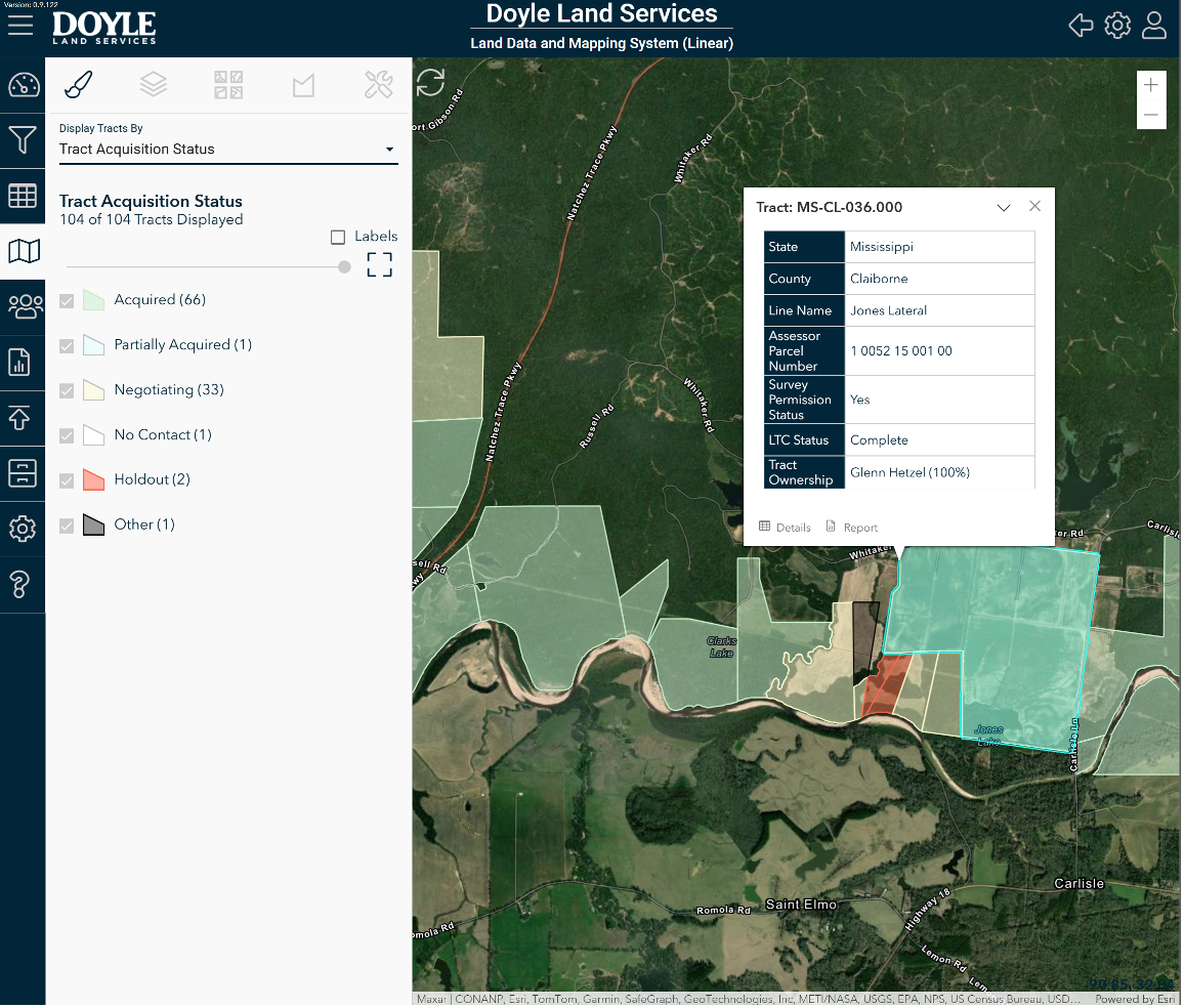
GIS Mapping
This comprehensive system gives you instant access to customized maps that show key statuses of your project in real-time. Additionally, we’ve included an Interactive Web Viewer that displays the entire project — including key statuses — in a GIS mapping environment.
Further, with Doyle Data and Mapping, you have complete control over customizing your reports, fields, and map. Making changes is simple so your reporting process can update as quickly as your project.
The Data & Mapping System can also serve as storage for your project records, including relevant ownership, maintenance and accounting reports. We’ve built this system from the ground up with your needs in mind, allowing us to collaborate, quickly and seamlessly throughout the life of the project.
Reach out and discover how the Doyle Data and GIS Mapping System can simplify your next project.